|
|
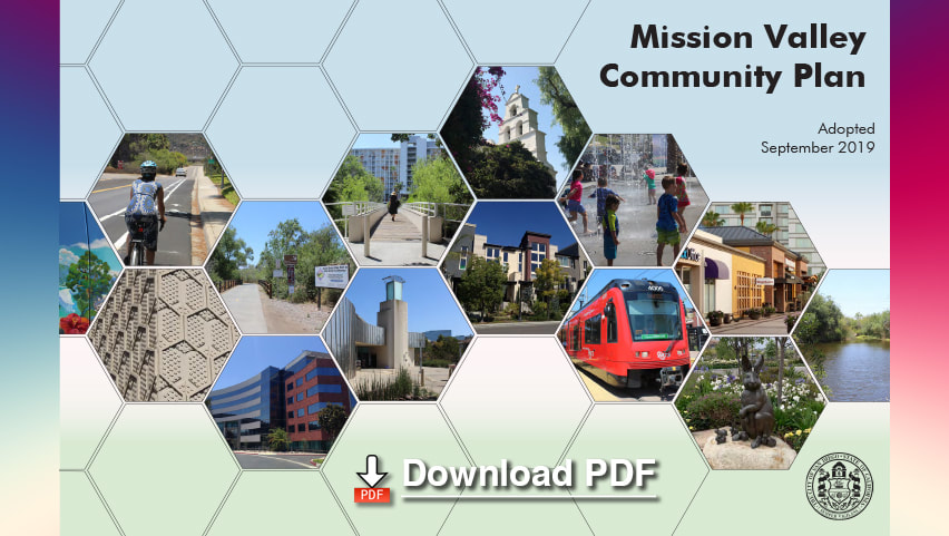
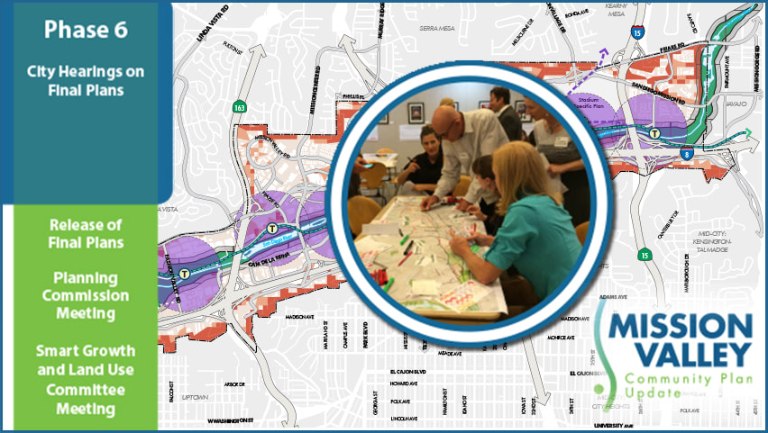
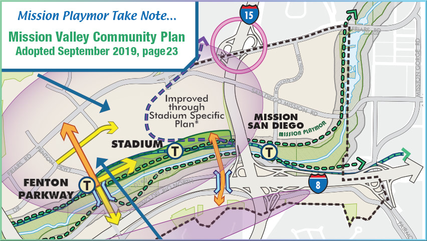
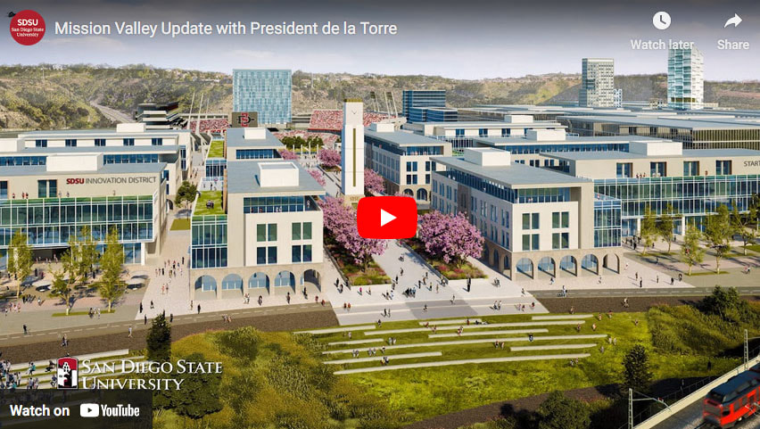
In 2015, the City of San Diego, in coordination with local community members, began updating the Mission Valley Community Plan, which serves as a blueprint for the future development of the community. After completing extensive research on existing conditions; gathering input from the Mission Valley Community Plan Update Subcommittee, community members, and stakeholders, on topics such as land use, mobility, and parks; and analyzing future conditions, the updated Mission Valley Community Plan was adopted unanimously by the City Council on Sept. 10, 2019.
|
|
Regional planners designing the
San Diego River Path
San Diego River Path
|
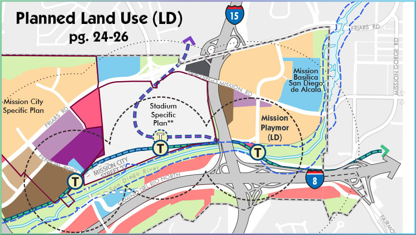
Much of the land in Mission Valley will be designated for mixed-use development. This development will occur either through total redevelopment of existing sites, or the creation of new uses coupled with existing buildings of differing uses. This plan will allow the economy of Mission Valley to continue to thrive while new homes are integrated into the landscape.
|
|
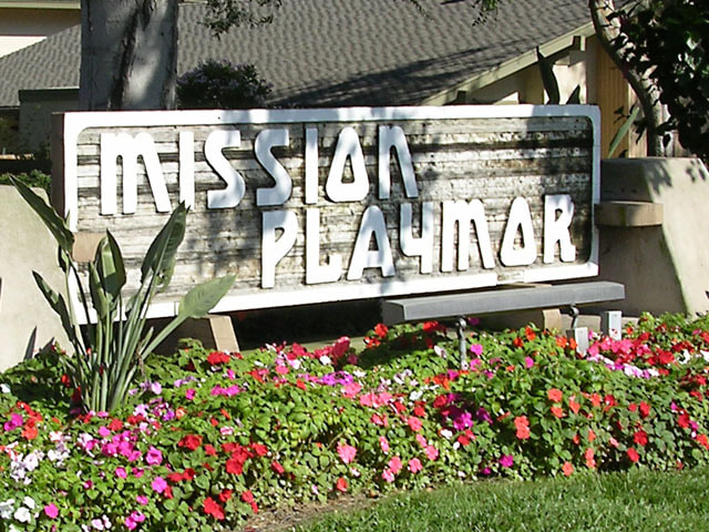
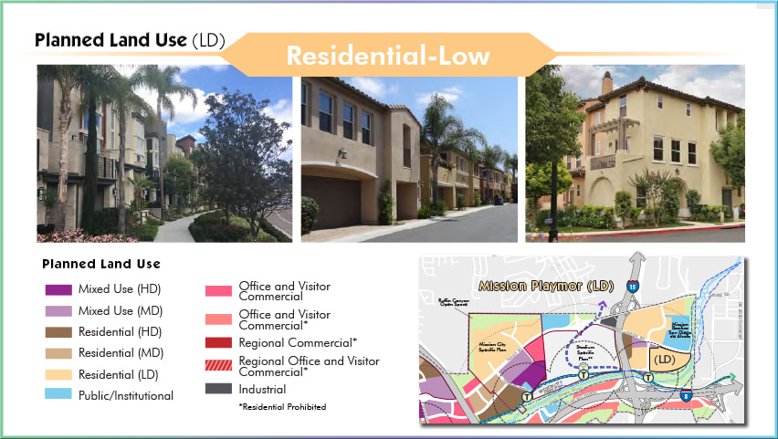
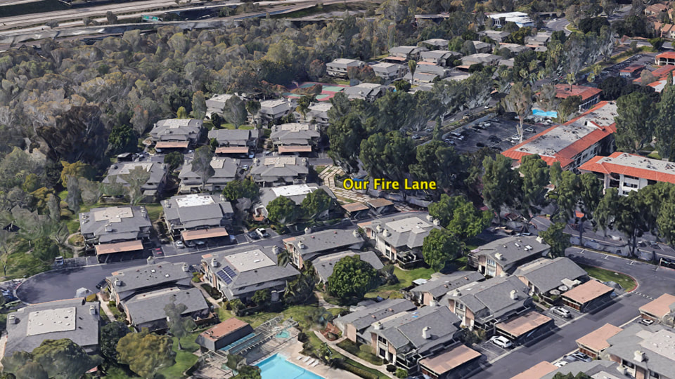
Mission Playmor's designation, (Residential LD), allows for condominium/apartment buildings that typically consist of residential units that include a centralized amenity with individual or shared open space areas, along with structured parking. This designation allows for condominium/apartment buildings that typically consist of two or three story townhomes with attached garages. Units often have individual and shared open space areas and amenities. This designation accommodates between 44 and 73 dwelling units per acre.
|
|
|
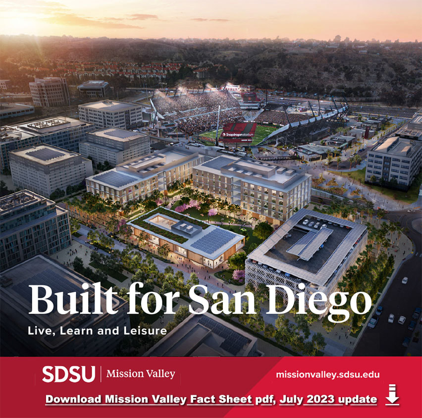
“We envision an inspiring new mixed-use community that will create a better way to live in Mission Valley,” said Mark Janda, Senior Vice President of Development for AvalonBay Communities Inc. “The new community will incorporate a range of design features that will promote walkability and connectivity throughout the surrounding neighborhood, all in a highly sustainable mixed-use building.”
In the coming months, the university and AvalonBay will work to finalize deal terms, with the goal of securing approval from the Board of Trustees for the California State University in 2023, with construction to begin as early as 2024. |
|
Mission Valley | Parkway Bridge
City, SDSU moving forward with plans for Mission Valley bridge over San Diego River.
City, SDSU moving forward with plans for Mission Valley bridge over San Diego River.
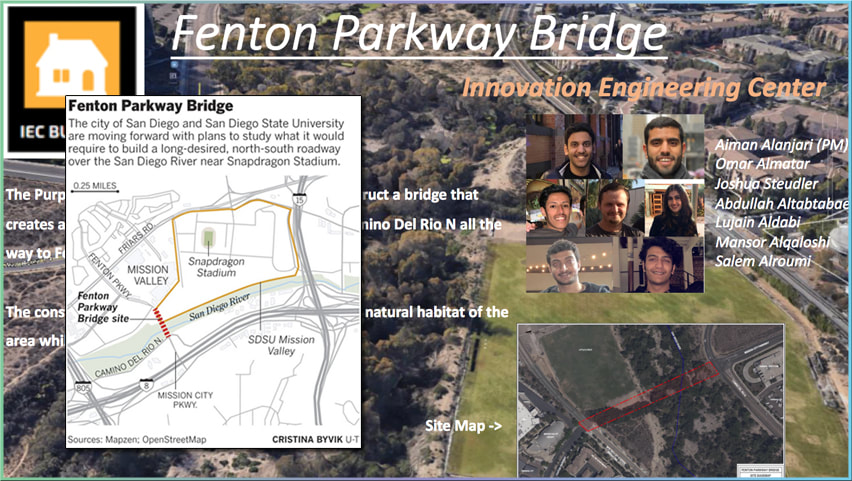
Fenton Parkway Bridge is currently envisioned as a two-lane road that would extend Fenton Parkway south over the San Diego River to Camino Del Rio North at grade with the trolley crossing and would accommodate cars, bikes and pedestrians. Today, the road abruptly ends at the Fenton Parkway trolley station, behind the IKEA-anchored Fenton Marketplace immediately adjacent to SDSU Mission Valley.
The multi-use bridge has been contemplated in various forms since the 1980s, most recently as an essential component of the new community plan to cushion the blow of 50,000 new residents. It resurfaced in 2019 as a sticking point when the city of San Diego was negotiating the sale of its Mission Valley stadium site to SDSU. The school went on to purchase 135 acres of land along Friars Road in August 2020 for $88 million, with a commitment in the purchase and sale agreement to build the bridge prior to occupying 65 percent of the site.
Source:
Fenton Parkway Bridge
click: SANDAG Report Summary
November 2021
November 2021
|
|
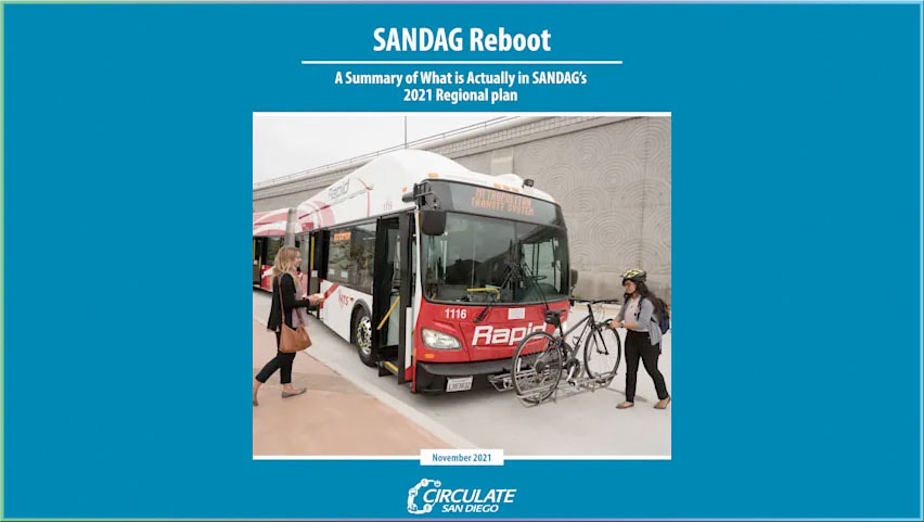
SANDAG Reboot is a summary analysis of the San Diego Association of Government’s (SANDAG) Draft 2021 Regional Plan (2021 Plan). It is intended to make SANDAG’s proposed plan more accessible to decisionmakers, the media, and the public.
|
|
|
River Park
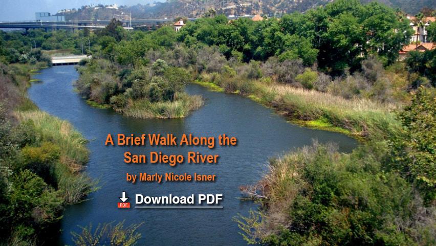
On May 20, 2013, the San Diego City Council unanimously voted to adopt the Master Plan for 17.5 miles of the San Diego River, stretching from the City of Santee to the Pacific Ocean at Ocean Beach’s world-famous Dog Beach. Needless to say it was a major step. in advancing the vision and dream of the San Diego River Park. The San Diego River Park Master Plan provides the vision and guidance to reverse this condition, to restore a symbiotic relationship between the river and surrounding communities by creating a river-long park, stretching from the San Diego River headwaters near Julian, to the Pacific Ocean at Ocean Beach. This plan is the result of the grass roots community efforts begun by the San Diego River Park Alliance (2001) and the San Diego River Park Foundation working in partnership with the City of San Diego. The River Park and surrounding area include:
The San Diego River Path, which when completed will run along the San Diego River from the ocean to Lakeside, and perhaps farther. Some parts of the path already exist. The Fashion Valley Bike Path is part of the San Diego River Path, and so is the path on the south side of the San Diego River between Mission Center Road and Qualcomm Way. The proposed bike path along the San Diego River between Ward Road and Zion Avenue will be part of the San Diego River Path when it is built. |
Courtesy of the County of San Diego
Department of Planning and Land Use
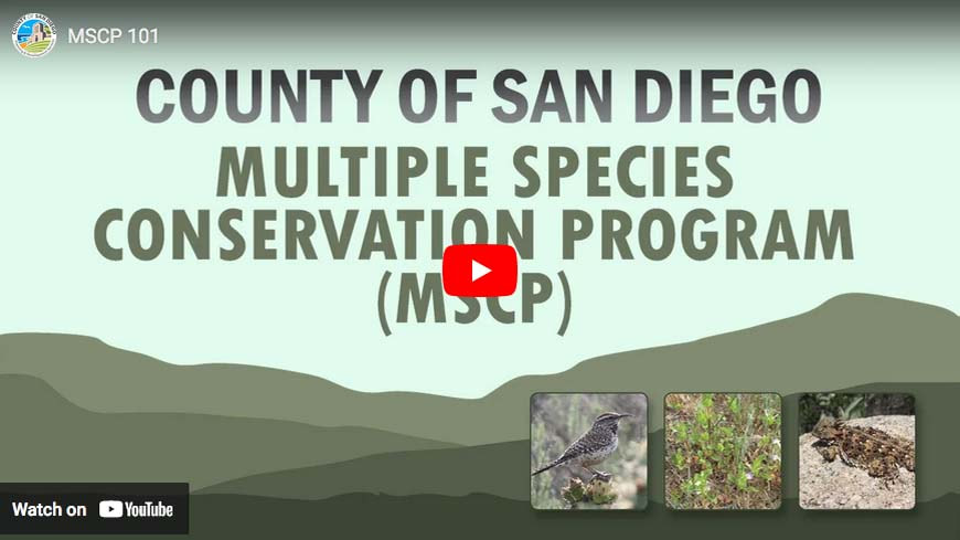
Multiple Species Conservation Program
5201 Ruffin Road, Suite B
San Diego, CA 92123
www.mscp-sandiego.org
RIPARIAN VEGETATION COMMUNITYSCRUB, WOODLAND, and FOREST
|
As a wetland, Riparian Vegetation is one of the most sensitive habitats in California. It has suffered the loss of thousands of acres as the result of clearing in the floodplains for agriculture, sand mining operations, and transportation corridors. Current estimates are that there are roughly 29,000 acres of Riparian Vegetation in the County, but much of that is now in fragmented patches rather than extensive stream courses. Good examples of Riparian Vegetation exist in Mission Valley near the San Diego Stadium, and adjacent to the Fashion Valley shopping center. This type of vegetation may still be seen in the San Pasqual Valley, around Lake Hodges, on the San Dieguito River, San Luis Rey River, Sweetwater River, and Santa Margarita River. Riparian Vegetation exists along stream and valley bottoms as well as deep canyons in areas where the water table is not far below the soil surface. At one time, all of the major riverbeds in San Diego County supported extensive areas of Riparian Forest.
When Riparian Vegetation is preserved, a surprising number of plant and animal species are protected. The indicator species for the presence of Riparian Vegetation are: several species of Willows, the broad-leaved Cottonwoods, Sycamore, and Mule fat, a shrub with greasy scented leaves.
The Willow, Cottonwood and Sycamore trees are winter deciduous. Riparian Vegetation is one of the most significant vegetation communities for wildlife. It is vital to many bird species including the endangered Least bell’s vireo and Willow flycatcher, as well as the more common American goldfinch, Yellow warbler, and Long eared owl. Small carnivores that inhabit Riparian vegetation include Spotted and Striped skunks, raccoons, and bobcats. Riparian Vegetation and associated stream courses are critical for a variety of amphibians including the endangered Arroyo southwestern toad, Pacific tree frog, and Western toad. Riparian Vegetation in the desert region includes an unusually large Mesquite forest in Borrego Valley near the Borrego Sink. Mesquite Woodland, sometimes called Mesquite Bosque, consists of a dense woodland of Honey and Screwbean mesquite trees. |
by Stephen Martin
Hi Lateefah,
Hope all is well with you and your family. The precious photo you emailed of your cute daughter in her school classroom with her Dad enjoying donuts brought an indelible memory to the forefront of my mind.
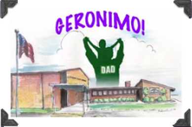
When I was a young boy attending Geronimo Elementary School in Ft. Sill, Oklahoma I twisted my right ankle playing tetherball during morning class recess. When I returned to my classroom and to my assigned first row seat I was quietly suffering severe pain as my ankle continued to swell and throb as lunchtime approached. My teacher, Mrs. Bostwick, excused the students in class for lunch promptly at noon. However, I sat paralyzed in the moment and remained in my seat while the classroom cleared. For some inexplicable reason I refused to move even at the earnest behest of my kind and patient teacher. I managed to withold my tears and remain as small and stoic as possible.
As I sat solitary in the classroom, Mrs. Bostwick gently inquired what was wrong and why I wouldn't rise from my desk to join my classmates. I stubbornly refused to reveal to her that my ankle was injured and that I was incapable of standing or walking. Why was I so reticent admitting to my teacher such a simple truth? I’m oblivious as to why I resisted her pleas, even to this day. As an experienced teacher yourself, Lateefah, you know more than most why kids are so puzzling and act in odd, mysterious ways. So, what happened next?
Twenty minutes passed by as I sat mute at my desk staring out the classroom window beyond the sunny horizon shared by billowing clouds. Now remember, twenty minutes is an hour in kids’ time and all the while I anxiously contemplated my immediate dilemma with no resolution in sight. I figured I’ll just be stuck in this permanent purgatorial space forever… helplessly doomed. The next thing I see in my periphery is my Dad suddenly appearing in my classroom in full military uniform…
MY DAD IS HERE!… inside MY elementary school classroom with dimensional spaces and boundaries designed just for small kids, teachers notwithstanding. Boy, was I surprised and extremely happy to see my Dad and my excited facial expression reflected my voluminous joy. With a purposeful gait, he hastened toward me, unveiled my issue, picked me up and effortlessly hoisted me up high above his shoulders. Dad elevated me so high I could reach up and touch the fluorescent white lights in the classroom ceiling. My legs were secured by Dad's strong hands and I swayed confidently on his solid shoulders. I was so high up in the air I began to feel super powerful. With renewed posture, I gazed far downward at Mrs. Bostwick and exchanged reassuring grins as my Dad and I escaped my self-imposed confinement.
Off we galloped, my Dad and me, like unbridled circus performers out my classroom door. My ankle feigned healing prematurely as I surveyed from above my superior new vantage point; my wiggled body springing up and down from the upward motion of each of my Dad's broad strides down the tunneled school hallway. I was giggling and willfully ignored the throbbing pain sensations in my ankle because now I was safe, secure and enjoined with my trustful Dad. At my Dad's instruction, I ducked my head as we exited the school's reinforced glass front doors toward the family's gleaming, black Pontiac LeMans.
Artificially tall and visually advantaged, I was now liberated outside into the open Oklahoma blue skies. Perfectly perched atop my Dad's steady shoulders, we zigzagged across the striped cement parking lot toward our family car. We drove off together to the military hospital clinic. After the attendant doctor wrapped up my severely sprained ankle, my Dad and I drove homeward toward our residence on Lester Road where I enjoyed lunch, rested and recovered during the remaining hours of the sunny day.
Lateefah, I'll never forget the rest of my life the day my Daddy rushed from work to Geronimo Elementary School to rescue me from my personal classroom drama and escort me to the Army hospital clinic. I love my Daddy too!
Keep the Faith,
Mr. Martin
“COMMENTS”
From: Lateefah
Date: February 18, 2013
To: Mr. Martin
Subject: Geronimo!
Wow Mr. Martin!!!!
You did it again! Thank you for sharing such a great story about you and your dad. I pray that Kennedy and her daddy have wonderful memories like that too. I think they're off to a great start! Thanks for the Donut with Dad movie! You sure do know how to (sniff, sniff...reaches for a Kleenex) make me cry! I can't wait to spend some time with you and Dr. Martin again! Three and a half months and counting…
From: Nicole
Subject: Re: Geronimo!
Date: April 7, 2014
To: Mr. Martin
Dear Mr. Martin,
First of all I would like to thank you for thinking of me and sending me this link. I love this story. I feel it really shows the importance we put into our parents. They bring us our security and have the ability to lift away our fears. They model what we one day strive to be. It seems as though your daddy is a very strong man and you learned a lot from him. It brings joy to read this and to be able to feel your love of this memory. Beautiful words.
In the video, that little girl sung beautifully! I also love the quote you have up, “The affirmation of one’s life —the acceptance of one’s destiny as it manifests itself at each moment — is the supreme act of faith.” It is all about believing in yourself (which I feel often times is learned from our parents). For, we may not know where we are to end up but we can have faith that it is where we are meant to be.
Thank you again Mr. Martin for your kind words of encouragement on the Guatemala trip. I will treasure them forever and I truly feel honored by your thoughts on my photography.
Sincerely,
Nikki
From: John
Subject: Re: Geronimo!
Date: March 24, 2013
To: "Steve Martin"
Hi Steve,
Great Story. It really goes to show how we hold our fathers in such high regard. I too remember many times as a young boy being with my Dad and feeling like he could do anything or solve any problem in the blink of an eye. A good father is a true super hero.
See you soon for our Guatemala trip!
John
On Nov 8, 2018, at 8:45 PM, Rachel wrote:
I am glad to hear you are feeling better Mr. Martin. Your recount of that experience with your dad coming to your elementary school classroom was very touching. You have such a descriptive way of writing and I think you would be a successful author if ever you chose to write about your childhood and overall development.
Your story somewhat reminded me of one my mother once told me about my grandfather. When she was in high school, on her 16th birthday, her dad came to her classroom and presented her with a bouquet of flowers, and no one else's parents were ever so heartwarming and bold in expressing their affections for an easily-embarrassed teenager. It's a beautiful story and I'm also glad that you shared one of your fondest memories with me.
-Rachel
From: Thelma
Subject: Re: Geronimo!
Date: December 5, 2013
To: Mr. Martin
Hello Mr. Martin,
Thank you SO MUCH! I LOVE LOVE LOVE this photo of the three of us. What great smiles! What joyfulness!
Thank you also for sharing your story with me, what a great one! I would loved to have seen your face as a young child and your expression when your dad walked in. When I was less than 5, maybe 4, I walked 1-2 miles from my home looking for my daddy to show him my new dress. He was at work, but I thought I could walk there. My mom didn't drive, so she had to ask a neighbor to drive her around looking for me.
Have a wonderful day!
Thelma
Site powered by Weebly. Managed by pair Domains
